York Minster

6/27/2017 Tuesday – York Minster

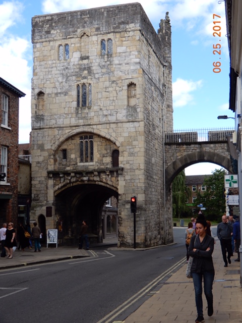
This city is a historian’s dream. It has 2000 years of documented history and an even longer archeological history. Celtic tribes occupied land where the rivers Ouse and Foss join. Then the Romans conquered the tribes. Then the Saxons took over. Then the Vikings conquered the Saxons. Then the Normans conquered everyone and they evolved into the present day British. Each contributed to the city, often building over or incorporating the previous occupants’ living areas.

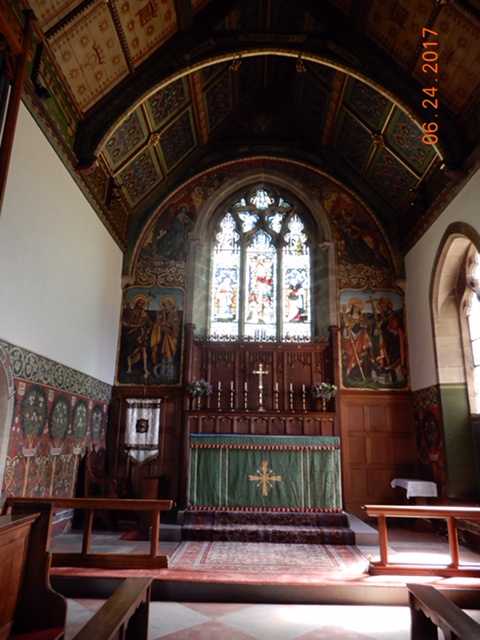
One place where we can see evidence of that history – at least back to the Romans – is the York Minster. The land on which the church rests was an important location. The Romans built a fortress there whose foundations can be seen in the Cathedral undercroft. The Christians built their first wooden church there in 627AD and shortly after that the first stone church was built. After the Normans came, the first large cathedral was built in the Norman architectural style. One hundred years later Gothic architecture became the rage for churches and in 1220 the cathedral we see today was begun.


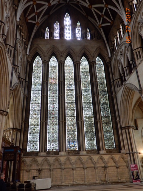
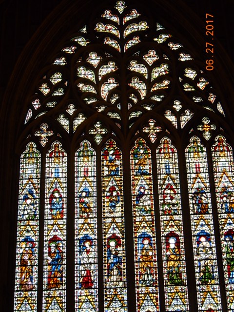
The York Minster dominates the skyline in York. It is the second largest Gothic Cathedral in Northern Europe (Cologne Cathedral is first). It is famous for its stained glass windows. The 76 foot tall Great East Window is the largest medieval stained glass window in the world. All four sides of the minster have windows of note. The south has a Rose Window. The West has the Heart of York window, the north has the Five Sisters – 5 lancets reaching up 50 feet.

7C4F3761-4A95-4F5B-B139-312017E20339
Five Sisters
3896CE75-ED70-43B7-B181-217F18B9FEEA
The Great East Window
EE263966-E085-4703-BF07-E49F91B4AD4A
Heart of York
DSCN1254
Rose Window


Fifteen stone statues representing 15 English kings make up the choir screen separating the choir (quire) from the nave. The kings begin with William the Conqueror and end with Henry VI.

DSCN1240DSCN1251

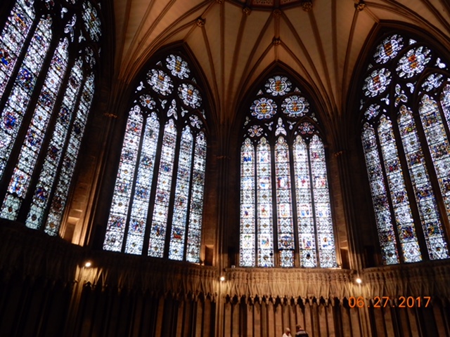
The Chapter House – the meeting place for cathedrals – is octagonal shaped and surrounded by still more stained glass windows, giving it a light and airy feel.
It costs £21,000 a DAY to maintain the Minster. An 800 year old building needs a lot of help to maintain its physical integrity, we gladly paid the £8.25 entry fee (which by the way, is good for a year, so if anyone reading this plans to visit York in the next year, look us up we have the tickets).
Some of that money goes toward restoring the stained glass windows. The artists and craftsmen are currently working on the Great East Window. While the lower ¾ of the window had been completed, parts of the upper window had clear glass wrapped in the lead outlines awaiting the restored pieces to be reinstalled.

Beneath all of this is the crypt and the undercroft. I missed the crypt, being too wrapped up in reading every word posted in the church, but I did get to the undercroft where the history of the land was displayed. The Minster sits above the old roman fortress whose remains were discovered in early 2000s during an engineering project to re-enforce the main tower above.
This fortress is where Constantine the Great was elected emperor by his soldiers and from here went on the create Constantinople and make Christianity the religion of the Roman world.
All told, it was pretty nifty.
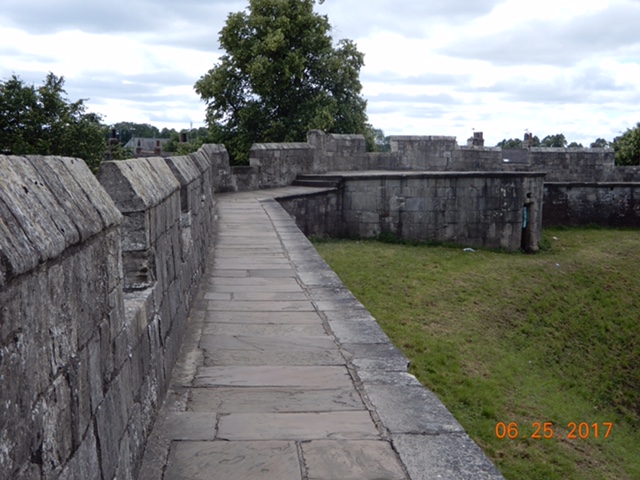
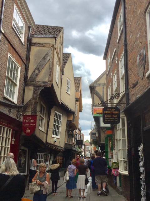
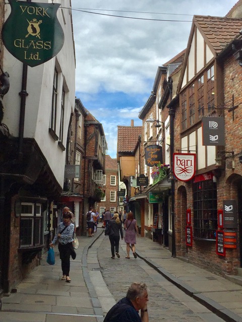
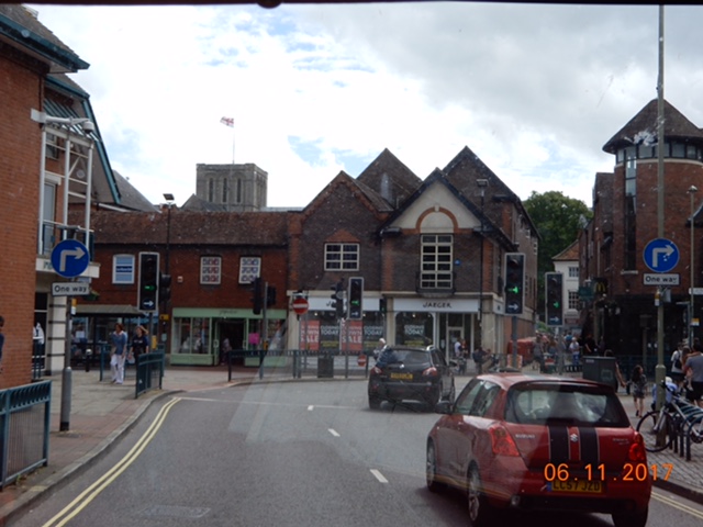
We left the minster to find a bite to eat and wander the streets some more before returning to the camping. We were on the lookout for a red devil, a golden bible and Minerva, goddess of wisdom, plus any cats we might find on the “cat trail.” The Devil, the goddess and the Bible originally represented store types; Minerva and the book used to be above book stores while the Devil represented a printer’s shop. The cats were just for fun.

Wednesday we were supposed to visit the Rail Museum but it rained all day and we stayed “home” hoping it would stop. It didn’t, so we extended our stay in York one more day to visit the museum on Thursday.


York

6/26/17 – York

Saturday morning, we left River Laver Holiday Park – our camping for Fountains Abbey. I have to say; it was an immaculate campground. It only had 10 spaces for touring caravans and motorhomes, its stock and trade is selling static caravans (park model trailers in US), but the park facilities and grounds were impeccable.
On our way to York from Ripon – a whole 41 miles – we missed a Roman site outside of Aldborough. We are greatly attracted to Roman ruins and ancient churches so this was a disappointment. As we continued along, Bruce spotted a road sign directing us to turn right to visit an “ancient church.”

DSCN1056
Ancient Church at Kirk Hammerton
DSCN1058
The Apse in Ancient Church

We drove a couple of miles down the requisite1-1/2 lane-wide roads until we reached the village of Kirk Hammerton and found our ancient church. The tower and south aisle was original Saxon work – built around 950AD (before William the Conqueror of 1066). Other parts of the church were rebuilt, destroying the old Saxon parts and replacing it with varying success throughout the church’s 1000+ year history. I was fortunate enough to share my viewing of the church with a couple who belonged to a group that studied old pre-Reformation churches. They shared some thoughts with me regarding the structure of this church.

We made landfall at our first York camping around 1pm. It was a family owned working farm that dedicated about ¾ acre to a certified camping site. They also raised sheep and goats and were quite successful bringing in the campers. At £22.50 per, we guesstimated they took in between £300-£400 the night we stayed. A very good supplemental income. We only stayed at the certified site for one night because we were lucky enough to find space at Rowentree Caravan Club site, located on the grounds of a public park right in town. Location, location, location! It couldn’t get any more convenient than this.

DSCN1064
York City walls
9B900063-13FB-4455-928B-7FE639D6A319
York City walls
BF7E4A70-06D5-42B3-83A1-AD09395737FD
The old Roman Walls
BBE9183C-B7AB-4ED0-B111-6B942F3C1780
Last remaining city gate with a barbican

Sunday afternoon we walked the York city walls. York has more intact city walls than any other city in England. The two-plus miles of wall have protected York for 2000 years starting with the Romans and continuing through Saxon, then Viking, then Norman occupations. The Romans built walls that survived to the Viking invasion. In the 9th Century the Vikings buried the roman walls with a dirt bank topped with a wooden palisade which remained until the present medieval stone walls were erected in the 13th and 14th centuries. There were four main gates – called Bars – and six secondary gates giving access to the city.

613D2579-2EE0-4A3B-B586-4C7F21D86A21
Butt-nekkid parader

We had visited York in 2000 but only walked a portion of the walls, Sunday we walked the whole thing. It’s pretty impressive. Along our way we heard someone shouting like a town crier in the streets and between buildings we saw a small parade of butt-nekkid male bicycle riders. We were only quick enough to get a photo of the last participant which we happily share. We don’t know, but we thought it may have been a Gay Pride event since such things were happening elsewhere in the world. It was fun to see!

Monday we walked the town within the walls. It looked like the weather, which has been very nice – high 60s – was going to take a turn for the worse beginning Tuesday. We needed to top off our SIM card after which our goal was to reach the Shambles, probably the most famous street in all of York.

FullSizeRenderFullSizeRender

The Shambles is a street in York City Centre dating back to at least the 14th Century (1300s). It was originally where the butcher shops were located. The name is believed to be derived from Anglo-Saxon “Fleshammels” (literally “flesh shelves”) or where the butchers laid their meats out for sale. It is famous for the overhanging half-timbered buildings leaning towards each other in a most picturesque manner. Originally those overhangs protected premature meat spoilage from sun exposure. Today, instead of butcher shops, restaurants, souvenir shops and the like occupy the street.

AA22E8A4-A4AD-4BFB-B811-D9E48891D143
Lunch at Shambles market – pulled pork wrap

An open air market was occurring in the square the Shambles opens onto and we had lunch there; a pulled pork wrap sold by an enterprising young chef who was introduced to the recipe while attending college in North Carolina for a year.
We spent the remainder of the day at the Castle complex museums.
The castle complex dates back to the time of the Norman conquest. In 1068 the Normans subdued rebels and Vikings and built a motte and bailey castle. A motte is a raised earthwork and a bailey is an enclosed courtyard protected by a ditch and palisade. A wooden keep (fortified tower) was on top of the motte.


An infamous event happened at Clifford’s Tower in 1190 when riots against Jews forced about 150 of them to take refuge in the wooden tower. Given the choice of conversion to Christianity or death at the hands of the mob, the Jews chose a third option: suicide. They set the tower keep on fire and died within as it burned. In present times, daffodils have been planted around the tower mound in remembrance of the massacre.


After the fire, the keep was rebuilt in stone and the remains of that structure is what we see today along with the castle buildings at the base of the mound. The castle buildings have housed courts, treasuries and prisons over the course of it 1000 year history.
Today, the castle houses a Victorian-age museum. In the late 1890s Dr. John Kirk began a passionate (I might say obsessive) collection of all things Victorian. In time his collection was so large that he struck a deal with the city of York to develop an innovative museum in the former women’s prison at the castle. The museum features period rooms and a re-creation of a Victorian street named Kirkgate. It is a fascinating way to spend an afternoon. As usual, when we visit museums, I read everything plaque and peruse every display ad nauseam. We’ve developed a rule that we cannot leave a museum gallery separately for fear of losing one another. Bruce is always finished before me and yet he is the most patient soul awaiting my arrival.

The Bronte Sisters & Fountains Abbey


6/22/17 – The Bronte sisters & Fountains Abbey and Studley Royal
We left Settle Thursday morning after checking our social media accounts and learned from Lisa T-H that we were in Bronte country. As my ignorance of the Peak District showed, our knowledge of English geography is terrible. We were in the Yorkshire Dales, but I always thought the North Yorkshire Moors in the east were the moors referred to in Charlotte Bronte’s novel Wuthering Heights. As voracious a reader as I am, I’m ashamed to say I have never read any of the Bronte sister’s novels. I have no clue about the storylines nor the locations in which they are set. All I know is sweeping moors play an important part in Wuthering Heights, and I have been to the the North Yorkshire Moors. In this case, one plus one does not equal two. The Brontes spent their lives in the Yorkshire Dales. In England a dale is a valley. Valleys lie at the bottom of hills
We were only 25 miles away from Howarth, the town the family lived in, and we decided we would visit the Bronte parsonage where the family spent almost their entire lives. We plugged Howarth and Bronte Parsonage into Tammy/Theresa and set off.

DSCN0956DSCN0952
The roads we followed took us over hill and dale, through wee little villages and onto wee little roads with 16% grades both up and down. At 12 mph it took us some time to reach the top of the hills and we saw a panorama of wind blown fields and drystone walls drawing crisscross lines across the hillsides. We got out of the van and were immediately buffeted by winds blowing across the hills. There was a sense of loneliness and isolation up there at the top and I could imagine that influencing the Bronte writing.
We still hadn’t arrived at Howarth, so we continued up and down hills along tiny lanes winding our way around villages until we finally came up to the village.

1EF18E57-2F24-445C-BBA0-429D3F9B89F7
The Bronte Church

IMG_1165

DSCN0979
School where sisters taught

There are a lot of literary people in this world. Three buses were in the pay and park lot and the village teemed with tourists. I had no idea this would be such a popular tourist attraction especially since it was so difficult for us to get there; we assumed it would be fairly quiet. We walked to the church where the patriarch, Patrick Bronte was parson for life (perpetual curate). He was a published poet so his six children grew up in a lettered home.

DSCN0982
The Bronte Parsonage

The Brontes were a tragic family. In 1821, after living only one year in Howarth, Maria Branwell Bronte, the mother of six children, died of cancer, she was 38. Four years later the two eldest daughters died of tuberculosis within months of each other. Branwell, the only boy in the family, died from alcohol and opiate addition at age 31. Emily and Ann, the two youngest sisters were 30 and 29 when they died. Charlotte managed to live through her 30s, dying just before her 39th birthday. Only Patrick lived a long life, dying at age 84, outliving all of his family. How sad.
Howarth was probably little changed since the days of the Brontes, most building were of the local stone with the stone shingles slowly weighing down the rooflines. Narrow streets were lined with small shops. I always wonder how the locals feel about the tourists than invade their home during the days. I can imagine that no matter how much money comes into the town, they are relieved to see the buses leave.

We left before the buses, taking a much easier route out of town and onward to Ripon. We were going to visit Fountains Abbey and Studley Royal Water Gardens – a World Heritage Site and an English Heritage Site.

DSCN1030

Fountains Abbey is one of the largest and best preserved ruined Cistercian monasteries in all of England. Founded in 1132, it became the wealthiest monastery in the land. During the Dissolution in the late 1530s, Henry VIII disbanded all monasteries, priories, convents and friaries, appropriating their income, disposed of their assets and pocketed the money.

Today the Abbey is part of the Studley Royal Water Garden complex run by the National Trust and English Heritage. The Studley Royal Georgian Water Garden is a park with water features, pathways, copies of classic sculpture all laid out on hectares of land that was designed by the father and son owners of Studley Castle grounds. Surrounding the Abbey and Gardens is the Studley Royal Deer Park, home to over 500 red deer and the lovely St. Mary’s Church.


The whole complex is unbelievably beautiful but the abbey ruins were the thing to us. We have seen some church ruins but this…this was something! The size of the abbey was shocking. It was built in an open meadow giving it a lot of room to expand, and it did. The ruins are stunning – we can only imagine how it looked in the years before the Dissolution.

A Three Horn Day

6/20/17 – A three horn day

Sunday found us on the road leaving Stratford-on-Avon towards the Costco at Coventry. Our intent was to drive by Warwick Castle for a photo opportunity. It is another iconic English Castle that has been restored and is now owned by Madame Tussaud’s. It has re-creations of different periods of the castle’s history and the entry fee was a lot steeper than we cared to pay. We asked Tammy/Theresa to direct us to the castle which she did with great alacrity. We were hoping for our approach to be via the river side where, if memory serves me correctly, the view is magnificent. Instead we went through the town and along the historic castle approach with beautiful old buildings lining the roadway towards castle keep. Then we took a wrong turn trying to find that photo view. We gave up and continued onward to Costco.
Bottom line is we have no photos to show the beautiful castle at Warwick.
We were on major roads that were busy with cars in a hurry to get home and prepare for the work week (we presume). The major roads had roundabouts with four lanes and directional traffic lights as well as four to six exit opportunities. It took a lot of concentration to keep all those variables in mind as well as to remember to drive on the left.
On the whole, Bruce has been an exceptional driver, but today we managed a three horn day. It seemed like every time we entered one of the complex roundabouts we pissed off some driver and were honked at. We fear we’re giving the Dutch a bad name.
We reached Costco around 11:30 and were amazed to see a half empty parking lot. British Costco’s are laid out identical to the American ones only they have British products – and we were so amused to see the misspelling of Tyre Centre on the side of the building.

35FABC3C-0E30-41C7-8B4C-688523C45712IMG_0349

As always, we found a few items we felt in need of and we had to have the £1.50 hot dog for lunch. While the deal is the same, our American Costco hot dogs are ever so much better.

We were still making our way towards North Yorkshire Dales and the Wednesday meeting about the awning room. Along the way was the Peak District. In all the years I have heard of Britain’s Peak District, it never once crossed my mind to equate the name with mountain peaks. There are four peaks in England that are higher than 4000 feet, so to our mind the Peak District is full of foothills. It is as lovely as reputed with rolling hills and exposed cliffs of limestone. Dry rock walls sliced across great open fields dividing them into sheep and cattle paddocks.

987A134D-0CE1-4371-B76F-E251EA0DF44F45A3C345-9D8B-4F9C-A259-81A00871968B

Monday we revisited Chatsworth Stately Mansion, staying at the Caravan Club on the grounds of the estate. We walked to the mansion in hopes of visiting the gardens but were foiled by high entry fees which we would have paid had we never seen them, but we have, so we didn’t. We remember that Europe (including the UK) requires entry fees everywhere (our reason for joining the English Heritage) and we are picking and choosing our sights. We did go through the stables, now a restaurant/gift shop and walked among ranging sheep on our way to and from the campground. The estate is several hundred acres of landscaping, designed by the famous 18th century landscape architect, Capability Brown. It’s fascinating to think of an architect planning out a design and planting trees and hedges and gardens, all the while knowing they will not reach maturity for 100+ years.

Six miles up the road from Chatsworth is the village of Eyam, famous for sacrificing 1/3 of its population to contain the bubonic plague within its town limits. The 1665 plague outbreak reached Eyam in September through a shipment of wool. As people began to die, the populous chose to isolate themselves in order to stop the spread of the disease. After 14 months the plague had run its course taking 253 local victims. Several houses – the plague homes – are still occupied. The parish church – St. Lawrence – dates from the 14th century and is surrounded by gravestones so worn by time as to be unreadable. A Celtic Cross from the 8th century is on the church grounds.

DSCN0929
Plague Cottages

DSCN0927

IMG_1122
14th Century parish church
DSCN0937
8th century stone cross
DSCN0943
Only brick bldg in Eyam

The whole town is built of stone with the exception of one building made of brick. Originally an inn known as The Stag’s Parlour, it became a residence in 1878, almost 200 years ago. I don’t know how long the building stood as an inn.
We left Eyam to continue our drive through the Peak District countryside. We traveled back roads working our way to Sheffield where we picked up the M61 highway in order to make better time to our destination: Settle, in the Yorkshire Dales.

6/21/17 – Settle

IMG_0366

We bought the Safari Room to attach to our awning, doubling our enclosed living space. This will come in handy when we stay in one spot for several days, and most especially this winter when we hope to stay put for several weeks at a time. Now all we have to do is get efficient at putting it up and taking it down.

Shakespeare’s Town

6/17/2917 – Stratford on Avon

I came to Stratford on Avon in 1995 with my parents on a two week whirlwind trip through England. I desperately wanted to share it with Bruce.
As is often the case when travel maturity is apparent; what once enthralled now seemed commonplace. The heart of the town was lovely but no longer felt special, we had seen enough English towns by now to recognize the combination of ancient buildings and 20 century businesses.

Stratford-on-Avon has been a tourist town for 500 years celebrating all things Shakespeare. He was born here on April 23, 1564 and died here on April 23, 54 years later, exactly bookending a life of acclaim in London. We visited his birthplace and walked along a cobblestone alley he most assuredly walked as well. We tried to imagine what 16th century Stratford on Avon looked like with old half timbered houses facing High Street in town center and the town flowing down to the river Avon. A market was going on in a market square, reminiscent of centuries past but with a lot more commercial goods rather than food stuffs. Books I’ve read always led me to believe markets were where farmers sold their harvest and townspeople stocked up on their fresh foods.

3EAFC011-EF9E-493B-BDFE-0E97E408C092

Walking into town from our camping we came across the Stratford on Avon Golf Club – established 1894 – and popped in to take a look. We spoke with the assistant pro in the shop and he gave us a little history of the place: Samuel Ryder – of Ryder Cup fame – was the the captain of the Golf Club in 1929 & 1930 and had hoped to have the first Ryder’s Cup tournament at that club but it was decided the course was too short.

6A5DF488-8FF6-47CA-AF0F-D178762A941B
Avon river and swans

The river Avon flows alongside the town and it was here, 22 years ago, that I got my first look at canal locks and the narrow boats and mini-barges that go through them. These boats are up for rent and a holiday of 1-2 weeks would be an exquisite way to pass the time traveling from one town to another and taking in the sights. (K&L – are you up for it?)
We are evidently becoming like the Brits, focusing on the weather, which for the last two days has been”spot on!” With highs in the mid 80’s its a bit too warm for us, but lots of people in the camping are exposing their bonewhite skin to the bright sun. Lots of sunburned people by days end!
We’ve been thinking of expanding our space with an awning room and found one online that fits our budget. We have been making our way towards York on the eastern side of the country but the room is in the Yorkshire Dales on the west. We will be making a detour to the town of Settle in hopes of collecting it. But first its off to Costco in Coventry (of Lady Godiva fame). I need my Costco fix!

The White Horses of Wiltshire

June 14, 2017 – White Horses of Wiltshire
England has a collection of gigantic chalk figures carved into hillsides throughout the southern countryside. They range in type from human figures to military crests to horses. The horses are probably the most common, and in Wiltshire – where we happened to be at the time – there are six in the area.
After spending the night at a camping just outside Devizes we consulted the map and began our quest.

According to written references, these white horses were carved out of the hillsides anywhere from 150 to 250 years ago. The turf is dug up to reveal the chalk hillside underneath, thus the name White Horses. They are 100’s of feet tall and can be seen from quite a distance away. Some communities actually have periods when the denizens make a day of it freshening up the figures by weeding out the new grass and resharpening the outlines.
To find them we set out on another series of small roads through delightful little villages. Our first find was the Roundway White Horse just north of Devizes. We were able to stop alongside the road and take our zoomed in photos.

8E14148C-DA23-41CE-8043-36D1D69A848E0F71370C-370E-4265-9641-BD987976AFF1

Then it was off to Cherhill, a few miles away, where we parked at a footpath pull-off to snap another couple of zoomed photos. The need for zoomed photos is that we can’t get very close to the Horses without loosing perspective, and the roads don’t get that close anyway.
Along with the Cherhill Horse are the remains of an Iron Age hill fort. One of those famous British footpaths leads up to them, and had we the time, we could have enjoyed a hike up to the top with 3 ladies waiting for us to get our camper out of their way so they could begin theirs.
Pulling out of our parking spot was interesting: we had to reverse our position (make a 180* turn around – in a parking space made for 2 cars) carefully because we were on the wrong side of the road. To continue our quest we had to make a right hand turn on a blind corner. In England, remember, one drives from the left, so a right hand turn crosses lanes just like our left hand turns do in the States.

IMG_102674F28C85-1454-43EC-A0EB-F640BCC466254F456AFF-EBF5-4BB8-B4E9-A19BD7077D67
Our next stop was Avebury, famous for its huge circle of standing stones whose diameter is nearly a mile. The town sits right in the middle of the circle. Avebury is an English Heritage site so we were able to park for free and explore the area. The town was lovely with thatched roof cottages (cottage is a misnomer – at least to me, who thinks small when I hear that word – because they are larger than my home – and much more charming) a Norman church in the middle of a graveyard and a manor house with well tended gardens. And the standing stones in their natural un-hewn state. The difference between these stones and the ones at Stonehenge is remarkable. If the Stonehenge stones started out like these, a lot of work was put into shaping them.

470695E1-1858-4845-8F28-3A84251F753748133861-76EA-45E7-ABFF-53B8BE602546
A few miles past Avebury was the Winterbourne White Horse – we had to drive up a private road to get our photo – and our last White Horse was at Broad Town along a long uphill well-traversed road.
Our drive was roughly oval shaped beginning at Devizes and ending at Swindon where we were hoping to find a caravan store to get a couple of parts we are in need of. The distance from Devizes to Swindon is 26 miles on the direct route but our ambling was probably closer to 40 miles.
Swindon was large and of course our route led us pretty much through the center, although the roads were larger and consequently faster- everyone is in a rush!
It was around 2:30 by this time. We were ready to get to the Cotswolds and we needed to find a place for the night. Consulting our camping books we found a Caravan Club camping outside one of our designated Cotswold towns – Bourton-on-the-Water – and made for it.
The Cotswolds are a stretch of hills beginning near Bath and heading northeast for about 80 miles. They are known for their distinctive colored stone and the beautiful towns made from that stone. The hills aren’t good for farming but were great for sheep raising and the towns became rich from the wool trade in the 1600s.
To get to our camping we took (another) side road that took us up and down hills and through tunnels of greenery on one lane roads. We passed through a couple of small villages before we found our camping and realized if we hadn’t turned off that side road we still could have arrived there in a much easier – but boring – way. The camping was interesting. There is no shower or toilet block, use your own facilities (thank goodness we have them) and that’ll still be 14 quid, thank you very much. It will only be a one-nighter for us, not only for the lack of facilities but it is 5 miles away from town so we must drive to see anything. Once we are on the road we ain’t coming back.

Salisbury and Stonehenge

6/13/17 – Salisbury and Stonehenge
Monday morning we had a bad scare about Bruce’s back – somehow while in bed it acted up and he couldn’t get out of pain the entire night. We were both pretty discouraged but he took an ibuprofen 800, did some stretching exercises and declared himself ready to walk into town.
Great Britain is covered in public footpaths – thousands of miles worth – and they are used quite extensively by the public. One path is right outside the campground and a short 1.5 mile walk took us into the heart of Salisbury, following the river Avon.

0C02059F-EE3D-4025-A71A-C824078DD65F
River Avon with Cathedral Spire in background

Our foremost reason for visiting Salisbury is the magnificent cathedral in the center of town but walking along the river we revisited the past via the architectural mix of old and new buildings that are 200 – 400 years old. They are build in brick or stone or are half timbered filled with brick or plaster. Walking down the streets of Salisbury you feel like you have walked back into the time of Queen Elizabeth Tudor. The McDonalds sign hanging on the corner of a 1700s building is what anchors you to the 21st century.

We walked through a stone gateway into the cathedral close. Unlike nearly all churches and cathedrals in the UK and on the continent, this close is unique; it is 80 acres of open grassy space on which the cathedral is centered. The perspective this allows for is wonderful. Most great cathedrals are set in compact squares with shops and markets crowding them and allow for no sense of magnificence the buildings deserve. Not so in Salisbury. Not only is there space to appreciate the structure but the cathedral is commanding in its own right.


Begun in 1220 AD, most of the work was completed in a mere 38 years. It has the tallest spire in the UK at 404 feet. When you look at the completed project you can’t help but appreciate the mastery of the stone carvers who worked on the project. Statues of saints, churchmen, kings and queens adorn the fronts. The cloisters – a covered walkway usually facing a garden area – is the largest and one of the loveliest in England. The chapter house – a meeting place – houses one of the four surviving original copies of the Magna Carta. It is noted for is octagonal shape and decorative medieval friezes that depict scenes from the Bible. When the cathedral was built, few people outside of the church could read or write. They were taught about the stories in the Bible by way of stained glass windows and carvings. The chapter house friezes are stone carvings telling Old Testament stories like The Creation, Adam and Eve and their expulsion, Noah’s Ark, Sodom and Gomorrah.


Because of time and natural elements, the cathedral must be continuously maintained. Stone carvers still work there, replacing worn stone from large statues to small pediments. We spent a short time watching a young man carving a cornice with hand tools.

We left the cathedral close and as we worked our way to the bus stop we came across the Poultry Cross –a market cross marking the former site of the poultry market. There used to be four such crosses in Salisbury including a cheese market, a livestock market and a wool or linen market. These “crosses” marked the area where local authorities granted towns the right to hold regular markets.
Finally, after a quick stop at a Tesco Market for bread and hair mousse we jumped the bus to return to the camping.
We are pleased to report that Bruce’s back is much improved and the day’s excursion did not harm him, and in fact, may have helped.

B121CACA-276F-4EB3-A786-A493EF1CDE8B
New city of Salisbury viewed from Old Sarum

Tuesday before driving to Stonehenge, we knew we had to visit Old Sarum.It was a two-fold purpose; to see the castle remains and to join the English Heritage Trust, an association that controls over 400 worthwhile sites to see in Great Britain. Because we are old, we were able to join the senior membership for £70 for 2 for a year. That is £35 each for a year’s membership. To enter Stonehenge without membership alone is £18 each so we will make our money back quickly.
After Old Sarum, we drove to that iconic group of standing stones erected about 4,500 years ago whose purpose is still unknown despite numerous theories.

DSCN0769DSCN0772

Stonehenge sits in the center of Salisbury Plains next to a very busy highway which takes away from its grandeur. Whatever engineer decided on that move should have been fired immediately rather than have his plan enacted. It does, however, give the casual driver a chance to see the World Heritage site.
We were late arriving at Stonehenge and did not beat the crowds that come in with the touring buses.
We were two among a gazillion tourists walking the demesne looking like ants following a trail of crumbs. The site is so awe-inspiring the crowds couldn’t diminish the impact. Years ago, people could walk among the stones, but in 1976 (or so) they were cordoned off to protect them from us. People were writing graffiti on them and disrespecting them. I would have loved to stand in the center of the circle and take in the view from within.

We are still heading to the Cotswolds, but we looked at our map and realized we were near several of the White Horse chalk hill figures. Tomorrow we go there.

Winchester (Ha!) & Old Sarum

June 11, 2017 – Salisbury

The two days of rest we took after Bruce’s back adjustment paid off. He says on a scale of 1 to 10 with 10 being no pain at all, he feels he’s an 8. Nonetheless we are babying his back until we are sure it is going to last.
We left Brighton Caravan Club around 10 am to go to IKEA in Southhampton, still searching for a summer weight duvet for our bed.
This was the real test for left handed driving. Bruce – numero uno driver – didn’t want to try the very small roads that traverse the middle of towns and villages yet so we opted for the dual carriage roads (two lane highways) and the occasional motorway (freeways). He got the swing of it fairly quickly but I am still a little jittery.
Our drive took us past Arundel Castle, a restored medieval castle begun in 1068 and owned by the Duke of Norfolk for over 400 years. It is one of several castles in the UK that is the perfect ideal of what a castle should look like.

DSCN0609
Arundel castle

By the time we reached Southhampton and the IKEA store – which we both expected to be on the outskirts of town – he was pretty good at maneuvering on the smaller roads, and it was a good thing because we quickly found ourselves in the middle of the town with roundabouts every three intersections and cars whizzing by.
Unlike American towns and cities which have the land to afford urban sprawl, the cities/towns/villages of the UK (and the Continent for that matter) where developed long before cars and lorries (semis) were invented. The consequence of this is roads that often began as no more than walking paths, in time became wagon width with houses and businesses built along the roads. There was no way to widen the roads without tearing down centuries old buildings, and it seems that Great Britain, unlike the U.S. has great respect for many things aged.
The IKEA store was smack in the middle of a HUGE shopping mall. We drove round and round and could not find the entrance to the IKEA parking area so we had to make due with a very tight parking lot with spacing for the typical SMALL European car. In order to fit in the space, we had to back in and overhang a third of the van into the flower beds. And then we had to pay to park.
We did find our duvet and used the rest of our paid time having lunch and mapping out our next destination: Winchester.

Ever since the song came out – in 1966(!!) I’ve had a hankering to visit Winchester Cathedral. It was still early in the day – 1:00 and I had the great idea that we could drive through the town to the cathedral, find a place to park, visit it and the Great Hall where King Arthur’s Round Table was hung. Winchester was only about 16 miles away and I believed we could accomplish the visit first then stop at a camping about 5 miles out of town for the night.

It’s amazing how often my plans go astray. The drive to Winchester was without incident. The drive within Winchester was an adventure. We couldn’t even get close to the cathedral. The downtown was barricaded to all motorized traffic and a festival or market of some sort was going on. The town was packed and there was no parking space available at all. We made two circuits with no success, so I still haven’t seen Winchester Cathedral.

DSCN0615DSCN0614

We changed tactics and decided to go to Salisbury, whose cathedral is the possessor of the tallest spire in all of England. By this time Bruce had the driving thing down pretty well, but after 4 ½ hours the small roads and continuous roundabouts were beginning to wear on him.
We wanted a camping that was as close to Salisbury as possible and after two false starts (one which led us to a golf cart track in the middle of a golf course) we finally found the Salisbury Camping and Caravanning Club Site. There are two main camping clubs in the U.K. We already belong to The Caravan Club and it looks like we should also join this one. You just can’t beat the deal, and a town where one may not have a site, the other probably will.
This Site’s location is at the base of Old Sarum.

DSCN0621

Old Sarum has a history dating back to a 400 BC Iron Age hill fort and there is evidence of a Neolithic settlement as early as 3000 BC. The Normans built a castle on the hill around 1068 and a town grew up around it: Sarum.
Old Sarum is also the original Salisbury. In the early 1200s a dispute between the local sheriff and bishop ended with the bishop moving his headquarters and his church 2 miles away on the banks of the river Avon. In 1220 the foundation of the new cathedral was laid and the new settlement of Salisbury or New Sarum was begun. Within 100 years old Sarum was abandoned.
If you are interested, there is a really good historical novel by Edward Rutherford called “Sarum” that chronicles the history of the area.


Brighton by the Sea

June 5, 2017

After an uneventful 4 hour ferry crossing we arrived in Great Britain on Monday at 3:30 pm Greenwich time. Now we are only 8 hours ahead of the Pacific time zone in which we live, rather than 9 hours.
We are driving on the wrong side of the road.
It is amazing what creatures of habit mankind is. The British follow the historic method of traveling along the left side of roads that goes back to the Romans. Since most people are right handed, soldiers – and later wagon drivers – kept to the left, leaving the sword arm – and later the whip arm – free for use.
Much later, in France, wide and heavy wagons with no driver seats, pulled by teams of horses or oxen, became a common mode of transportation. The driver sat on the back of the rear left horse/oxen, whip in hand, and directing the team from the right side of the road became more convenient. Napoleon decreed right handed driving to be the law, which spread throughout his conquered lands. America followed suite with their large and heavy wagons, and so the right hand driving experience became engrained into our psyche. Now, Bruce and I will be driving against every instinct.
Fortunately we only had to drive 12 miles following other cars which helped us stay on the correct side of the road. Still, it was a tense 12 miles since we were not driving in our natural state.
I had forgotten to write down the address of the Brighton Caravan Club Site while I still had wifi so we were unable to use T/T/T for directions. We drove by the seat of our pants using memory and maps and arrived with minimal shouting at each other. It’s a sad state of affairs to admit how dependent we have become on GPS mapping applications.

June 8, 2017 – Still in Brighton

Poor Bruce and his back. He has been dealing with pain for the whole time we have been in Europe – some days he is in less pain and some days more but he hasn’t had a pain free day since we arrived.
We arrived in Brighton on Monday and had hoped to get a Chiropractor appointment on Tuesday. The Caravan Club had space for us until Friday which would give us 2-3 days for Bruce to indulge in some R&R. As it turned out we couldn’t get an appointment until Thursday which was a bit of a problem if we had to leave Friday. Fortunately spaces opened up and we wrangled another couple of days out of them. An Itasca Suncruiser was parked right across from us -it  looked so much like our Queenie at home, we had to go introduce ourselves:

IMG_0849
The doctor did his thing on B’s back, and while it is sore – often the aftermath of a wrestling match with a chiropractor – we are hoping it will have done him some good. He was given a regimen of stretching exercises that I intend to nag him into doing daily.
The result of this back issue is a major slowdown in our sightseeing capabilities. He can’t walk for any distance or handle the jarring of bike riding so we are limited to only a couple of hours each day. We both want this resolved so we can get on with our travels.
We have taken the bus into Brighton twice now but on both trips we were on missions. The first was to get SIM cards for our iPhones and iPad, and the second day was the Chiropractor. We may not be getting to walk the town much but the bus does a good job of giving us an overview of the city.
It is one busy place. It seems like Brighton is much bigger than we imagined with a large downtown area filled with a lot of people taking advantage of a lot shopping opportunities. We walked through The Lanes – a historic area known for its twisty alleyways and filled with pricy antique and specialty shops. We ate fish and chips at a little restaurant on the seashore promenade and took picture board pictures of ourselves on the Brighton Pier (one of our very favorite pastimes.)

IMG_0843

IMG_0838
We got on and off the buses at the Royal Pavilion – a fairytale palace right out of “1001 Arabian Nights” built for King George IV, the son of Mad King George III, who lost the colonies in the American Revolution (and is portrayed wonderfully in the musical Hamilton).

DSCN0602
We will give ourselves a day of rest and do some much needed laundry and hopefully return to town one more time before we leave on Sunday.
Next stop: Winchester Cathedral.


Luxembourg City & Bastogne

May 30-Tuesday – Luxembourg City

Luxembourg City was a disappointment. I remember being knocked over by the old town during our first visit; the esplanade above the Petrusse valley, the Adolph bridge spanning the valley and connecting the city as it grew, the castle, the cathedral, they left a mark on my memory that did not hold up to scrutiny.
This visit we recognized how wealthy the city is; it is the banking capital of the EU with the second highest per capital GDP in the world. That means the people of Luxembourg AVERAGE over $80,000/year income. You know what else that means? It means all the top European name brands set up shop in Luxembourg City. Yves St Laurent, Gucci, BCBG, Chanel, Versace, Zara and one I could afford: H&M.
The past weekend was very hot; a preview of the summer to come. I did not bring enough lightweight clothes to get me through the summer so I was in search of something apropos. I did find a shift top that is the beginning of my summer wardrobe.
After only a couple of hours we decided we had seen enough and found our bus #194 to take us back to the camping. As we sat quietly on the bus, watching the stops come up on the screen and waiting to recognize ours, a lady standing at the exit asked if we were campers and if so, we should get off with her. We were dumbfounded that she would recognize us as such. We still don’t know what gave us away.
Back at the camping we welcomed Willie’s brother – a Dutch Citroen Hymer that was almost identical to ours. It was a 1993 model while ours is either a 1991 or 1992. We waved cheerily to them as they entered camp and soon the owner came by to compare notes. He showed us several features we didn’t know – like where the missing gray-water hose was stored and that our key worked in the door. We were given to understand that both our exterior door locks were broken and went through a whole rigamarole to get the door secured. It was still necessary to add the one exterior security door lock but we finally try our key in the “broken” lock only to find it works. We never would have tried the lock if Willie’s brother’s dad hadn’t tried his key in the lock just to see if it worked. It did and so did ours. Go figure.

Wednesday, May 31, 2017 – Bastogne, France

After a stop at IKEA unsuccessfully searching for a summer comforter, we drove to Bastogne, Belgium, the location of the famous WWII Battle of the Bulge.
Bastogne was a crossroads to seven different cities/towns that led the way deeper into the continent. Whoever held the city could stop approaching armies from advancing. It was a last ditch effort by the Germans to regain dominance in the war they had basically lost by that December 1944.
Bastogne was pretty much blasted to bits but has been rebuilt quite charmingly. It appears to hold the American Army in high esteem; there are many remembrances in the town of their victory.
We stayed one night at Camping Renval, just outside the city center; an easy walk into town and an even easier bike ride. Parking our bikes at McCauliffe Square we wandered up and down Le Grand Rue – Main Street – watching people as they carried on with their daily routines. Bruce was hoping to find a Frites shop open so we could have some Belgian fries but this part of Belgium is Walloon and respects the French tradition of closing up shop in the afternoon for a couple of hours. Instead, we hopped back on our bikes and went grocery shopping at a Carrefour Market near the camping.
A British couple, Mark and Claire, are camped right next to us and after dinner we went over to their pitch and visited for a few hours, swapping stories and enjoying the ability to speak with others in our mutually native tongue. They shared some tidbits on places to visit while in the U.K. They were at the beginning of a 3-4 week holiday; perhaps we will catch up with them while we are in Britain and after they return.

DSCN0553
Next morning we drove to the Bastogne WWII memorial museum where we were reacquainted with the history of the war. The museum, with the accompanying audio tour, walked us through the beginnings of Hitler’s power to the end and his downfall with special emphasis on the happenings in the Ardennes where Bastogne lies and the Battle of the Bulge took place. It was very well done. Outside is a huge five-point star shaped memorial with the name of each U.S. State engraved on it as well as the story of the battle told on ten panels. Walking up the staircase to the top of the memorial I was met with a beautiful 360* view of the countryside and Bastogne itself in the near distance.

DSCN0557

DSCN0545
Then we got back into the car and began our run to the coast of France where we planned to jump a ferry from Dieppe to New Haven, Great Britain on Monday.