8/26/17 – San Malo
After much consideration and taking into account the amount of time we have left for our trip, we have once again changed our itinerary. This cannot come as a surprise anymore, we have been continually changing it since we arrived in April. We will be going home in a little over a month so rather than spend long hours driving to Spain and Portugal and then turning around and driving long hours to return to Utrecht, we have decided to spend our last month in France and take our time to enjoy what France has to offer.
On Thursday, 8/24 we left the beaches of Operation Overlord and drove west towards Brittany to visit San Malo. Along the way we planned to stop at Mont St. Michel, the incredible monastery in a tidal basin that is daily cut off from the mainland by the tides. It was a place of religious pilgrimage for centuries. In modern times it is a tourist Mecca but still carries a wonderful aura of sanctity if you will take the time to wade through the layers of tourism. We have stayed twice at a conveniently located camping at the far side of the causeway to the Mont and thought it would be fun to have lunch there and take some new photos of one of our favourite places in France.
The approach to St Michel has changed in the 8 years since our last visit. No longer can we drive to the causeway and to the camping, but rather we, and all the cars, campers and tourist buses are herded towards pay and display parking lots were we then can board shuttles to the monastery. The parking is several kilometres from where we once could camp, and in fact we don’t even know if the camping is still there. The parking lots were almost full and the vehicles being funneled into the lots were backed up waiting to get in.
It was awful.
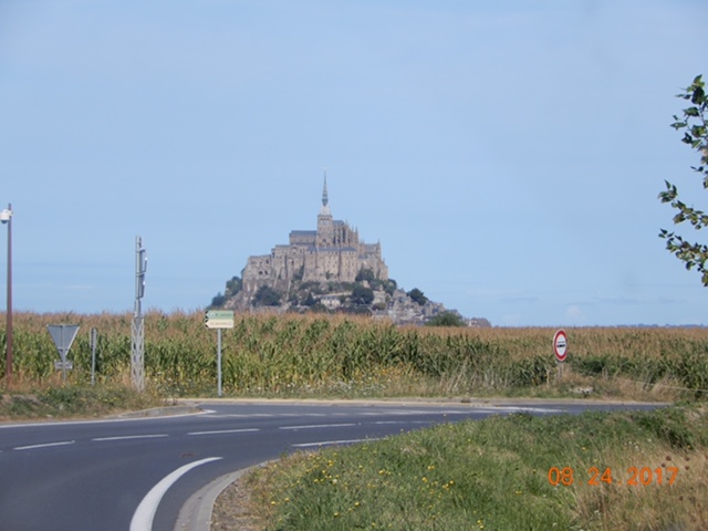
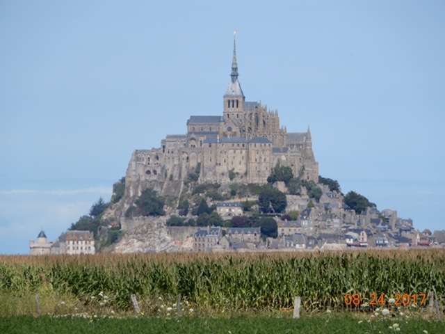
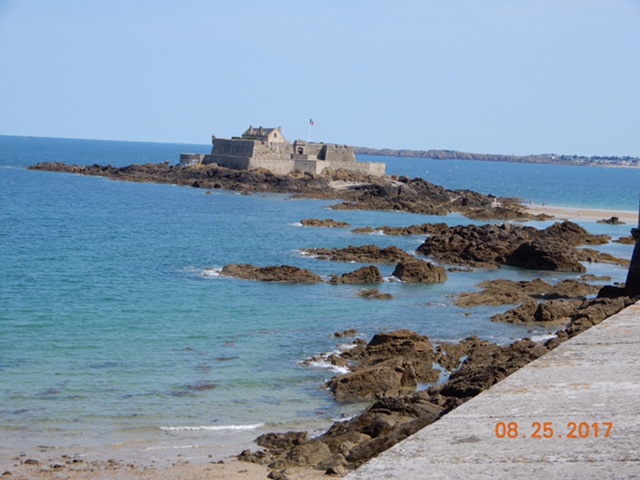
We chose not to add to the madness. We got out of the traffic mess and stopped at a little frites stand where we made our lunch, bought some fries and took zoomed-in photos of one of our favourite places in France.
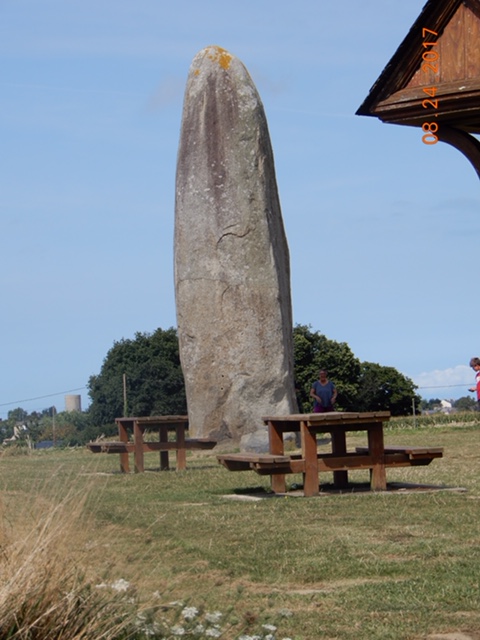
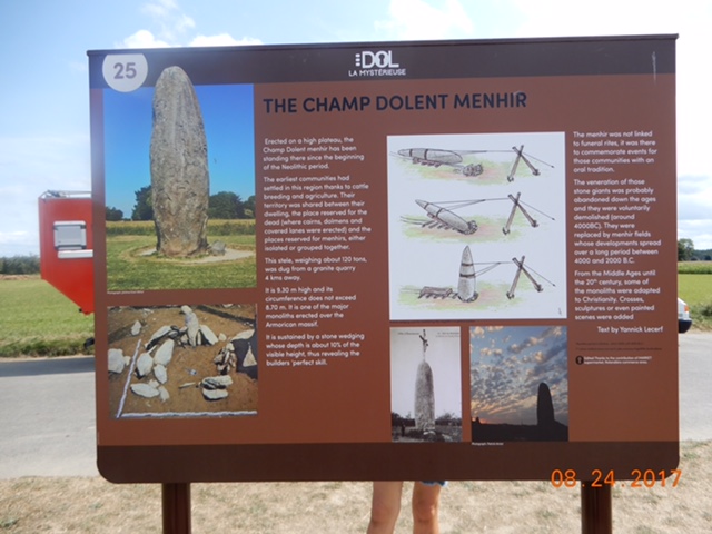
On our way from Mont St. Michel, looking at our map, I saw we were not far from a menhir (standing stone) we saw on our last visit to Britanny. It is called Le Champ Dolent and it is the tallest standing stone in Britanny, if not all of France. We detoured to see it again and it was as impressive on second viewing as it had been on the first.
A couple of years ago I read a book “All the Light We Cannot See” by Anthony Doerr. It is a novel of WWII. The walled port city of St. Malo, in eastern Britanny, has a starring role.
St. Malo, only 56 km from Mont St. Michel, had never been on our radar before, but the reading of this book definitely made it a must-see.


We found a camping very near the city on a small peninsula across the harbor: Municipal Camping de la Citi d’Alet. Alet was the original settlement of the area going back to Celtic and Roman times.


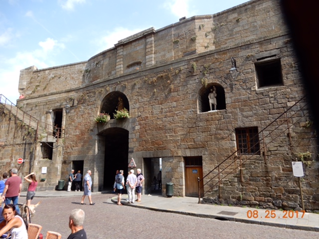
In the 18th century a fortress was built whose most recent occupants were the Germans in WWII. Our camping backs right up to the fortress.
During WWII the Germans took over the area, with that fortress behind our camping as a major defensive fortification. In August, 1944, with the Allied Forces advancing on Britanny, a major battle occurred as the Germans did everything they could to destroy the harbor of San Malo. The shelling between the Germans and the Americans bombarded San Malo and destroyed 70% of the city. The city was meticulously rebuilt in 12 years, from 1948 to 1960.
Somehow, on this trip we seem to be made aware of the incredible destruction WWII had on the cities and towns of Europe. Anyone who studied world history in high school or college is made aware of the destruction caused by war, but I think perhaps it is our visiting of these small compact cities, like Ypres and San Malo, and learning of the specific rebuilding projects they endured to come back to life, that makes it so immediate for us.
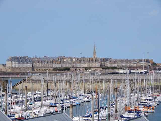
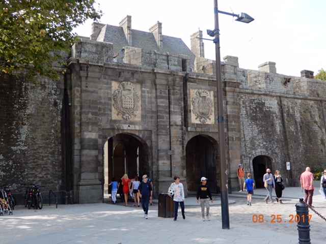
We took the 30 minute walk into San Malo on Friday, circumnavigating the busy harbor and entering the city through the Grand Gate. San Malo knocked our socks off. It is a compact walled city that occupies a small spit of land jutting out into the sea. It has mast-filled marinas on the land side of the city and sandy beaches on the English Channel side.
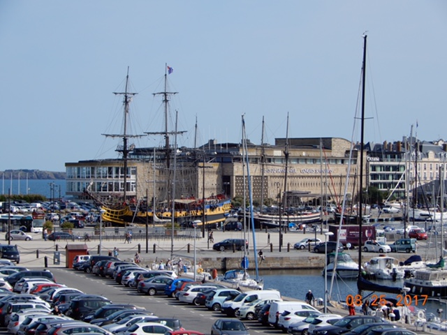
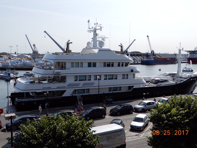
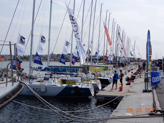
Approaching the city we walked the marina and saw a variety of ships. Among many, many others, we saw two replica corsairs, a four-storied yacht registered to the Cayman Islands and 24 Figaro-class, 2-man crew sailing ships preparing for a 6-day, 6-stage race around the coast of Britanny.
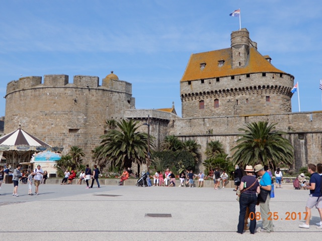
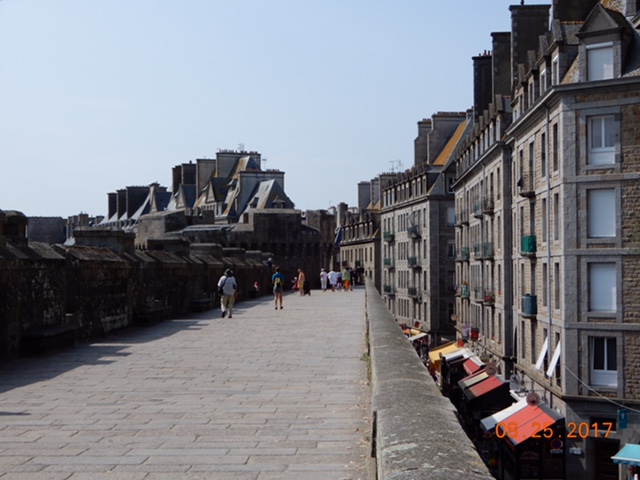
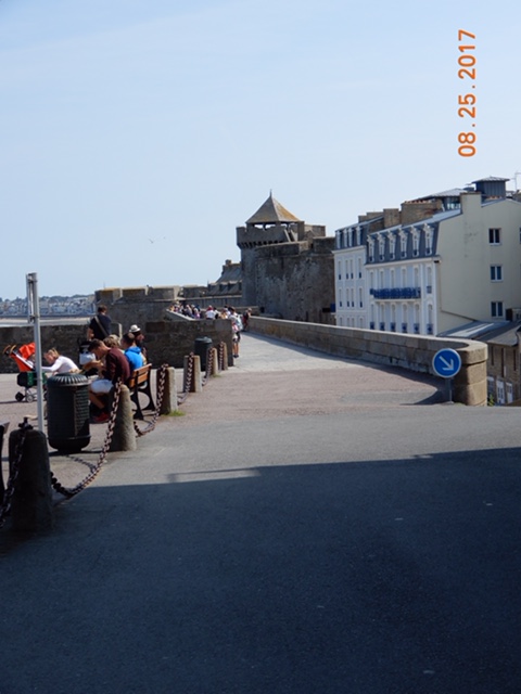
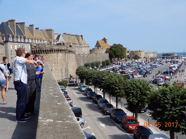
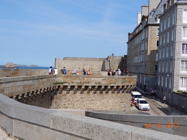
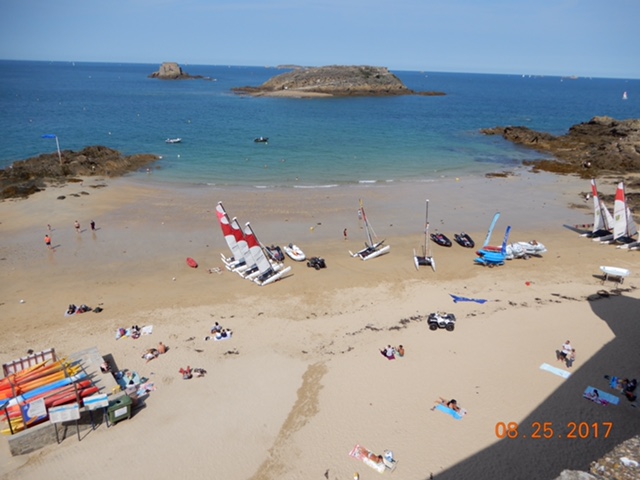
A walkway on the top of the ramparts takes you all the way around the city with gorgeous views on both sides of the wall. From a distance the city rooflines appear to be of uniform height and colour with Mansard-style roofs. A single tall church spire reaches up from the middle of town. Two fortified islands – Petit-Be and Grand Be – are accessible when the tides are low. A famous author from San Malo – Francois Rene de Chateaubriand – is buried on Grand Be. (I hate to admit it but the only Chateaubriand I am familiar with is the cut of beef.)


The town inside the walls has narrow cobbled streets, handsome stone-work exteriors on refurbished buildings and a restored cathedral with beautiful stained glass windows. The cathedral spire – one of the first casualties of the battle at San Malo – was not restored until 1971.


The cathedral has a unique bronze alter with the symbols of the four evangelists on each corner; a lion, an eagle, a man and a bull. The tomb of Jacques Cartier, the explorer who claimed Canada for France, is in a side chapel of the cathedral and a plaque commemorating the blessing of his first voyage in 1535 is in floor of the nave. There were lots of tourists and lots of shops and restaurants catering to them and yet it did not distract from the ambiance of the city.
We returned to our pitch very pleased we had decided to visit San Malo.
